East-West Center, Honolulu, USA
National University of Singapore, Singapore
NUS College of the National University of Singapore, Singapore
Keywords: mobility, b/ordering, Mekong, Cambodia, socionatures, hydrosocial relations
DOI: 10.5509/2024972-art6
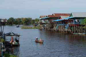
Hydropower development taking place on the Mekong River’s mainstream and tributaries across the river basin, including Cambodia, is threatening livelihoods and food security by altering critical mobilities associated with the unique ecosystems of the Mekong River. In this paper, we seek to understand how a politics of mobility around hydropower development links both human and nonhuman entities along the Mekong River in Cambodia. We examine how dams transform myriad localized cross-border and riparian political geographies of the physical-human landscape through partial enclosures, up-downstream reorderings and b/orderings of hydrosocial relations. To explain these transformations, we posit that it is necessary to pay attention to the politics of human and nonhuman (such as water, sediment, and fish) mobilities that are shaped by hydropower dams and the new forms of mobilities engendered as a result. We examine how hydropower development renders water, fish, and sediment immobile, or alters their routes and rhythms in ways that optimize the generation of hydropower but which create new concerns around these changing nonhuman mobilities for riparian communities in Cambodia. There is a tension that exists between technical representations and community experiences of these nonhuman mobilities, which raise implications for the exacerbation of vulnerabilities among Cambodian Mekong communities. In this paper, we focus our analysis on selected sites in Cambodia: 1) Stung Treng Province, downstream of Laos’ Don Sahong Dam and the Cambodia-Lao border riverscape, and 2) the Tonle Sap Lake (water-based and floodplain areas), to highlight these changing mobilities and the critical processes of b/ordering.
柬埔寨持续变迁的河流景观中的流动性和边疆化/排序的政治
关键词:流动性、边疆化/排序、湄公河、柬埔寨、社会自然,水文社会关系
包括柬埔寨在内的湄公河干流和整个流域的支流上进行的水电开发改变了与湄公河独特的生态系统相关的关键流动性,从而威胁到人们的生计和粮食安全。我们在本文中着力理解围绕水电开发的流动性政治如何将柬埔寨境内湄公河沿岸的人类和非人类实体联系在一起。 我们考察大坝是如何通过部分封闭和对上下游之间水文与社会关系的重新排序和边疆化/排序,转化了物理与人类景观中多种地方化的跨边境和沿岸政治地理。为解释这些变迁,我们设定有必要关注水电大坝所塑造的人类和非人类(诸如水、沉积物和鱼类)流动性的政治,以及由此产生的新形式的流动性。 我们考察了水电开发怎样致使水、鱼类和沉积物停止流动,或是通过优化水力发电的方式改变它们的线路和节奏,但却围绕这些不断变动的非人类流动性为柬埔寨沿岸社区制造了新的忧虑。这些非人类流动性的技术性表现和社区体验之间存在着一种矛盾,对于加剧柬埔寨湄公河社区内的脆弱性具有一定的意味。在本文中,我们集中分析几个选定的柬埔寨地点:1)上丁省、老挝洞沙宏大坝下游和柬埔寨-老挝边境河流景观,以及 2) 洞里萨湖(水基和洪泛区),解释了这些变迁的流动性以及关键的边疆化/排序的过程。
Translated by Li Guo
